Explore the Best Hiking Trails in Murcia & Valencia
Discover stunning landscapes, hidden gems, and scenic routes for every adventurer in Southern Spain.
Top 10 Hiking Trails in Murcia and Valencia
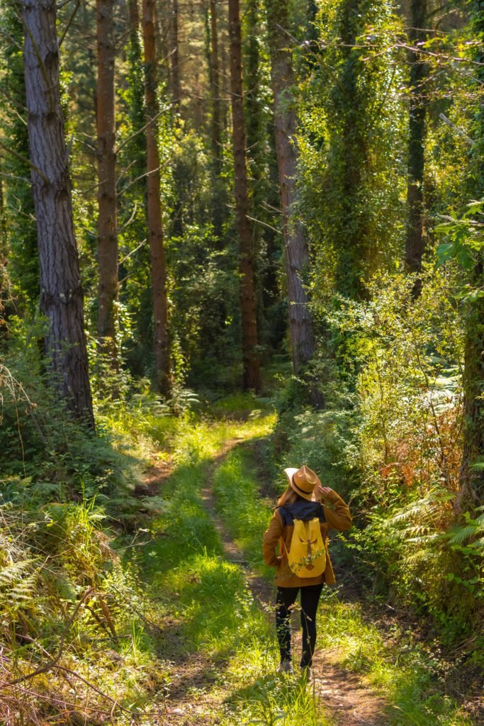
Sierra Espuña Natural Park
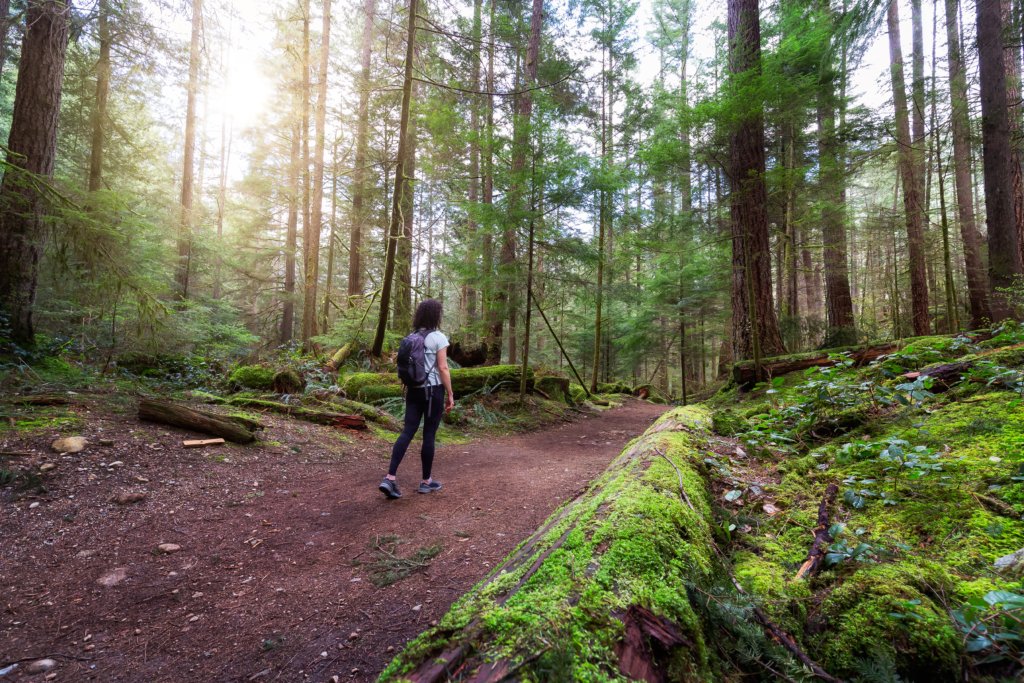
Nestled in the heart of the Region of Murcia, Sierra Espuña is a breathtaking natural park offering a mix of lush Mediterranean forests, rugged mountain peaks, and expansive views. With trails suitable for all levels of hikers, it’s the perfect destination for those seeking adventure, tranquility, and a chance to immerse themselves in nature. Whether you're exploring the forested paths or taking in panoramic vistas, Sierra Espuña promises an unforgettable hiking experience.
Highlights: Mediterranean forests, panoramic mountain views, and diverse flora and fauna.
Difficulty: Varies from easy to challenging.
Details: The park offers multiple well-marked trails, including the PR-MU 57 and PR-MU 41, suitable for all levels of hikers.


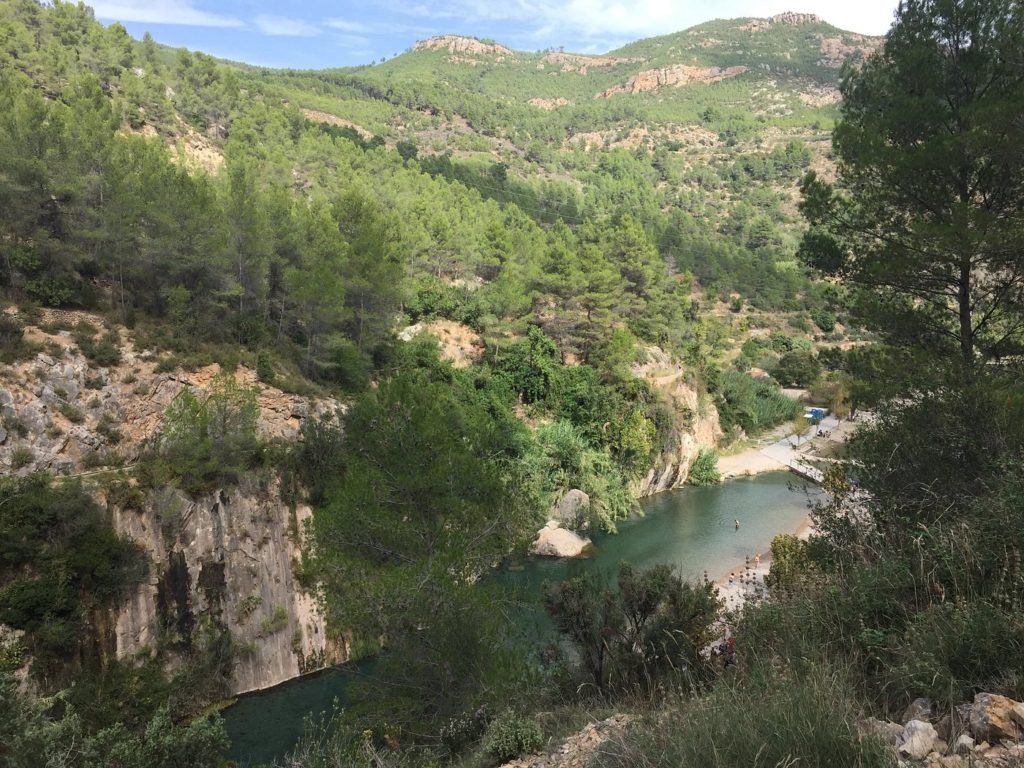
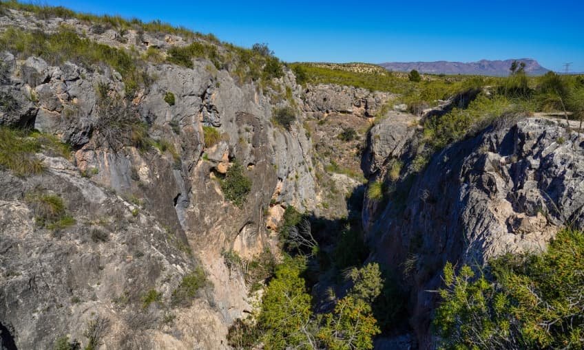
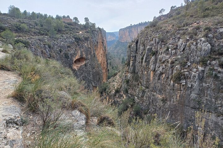
Almadenes Canyon (Cieza)
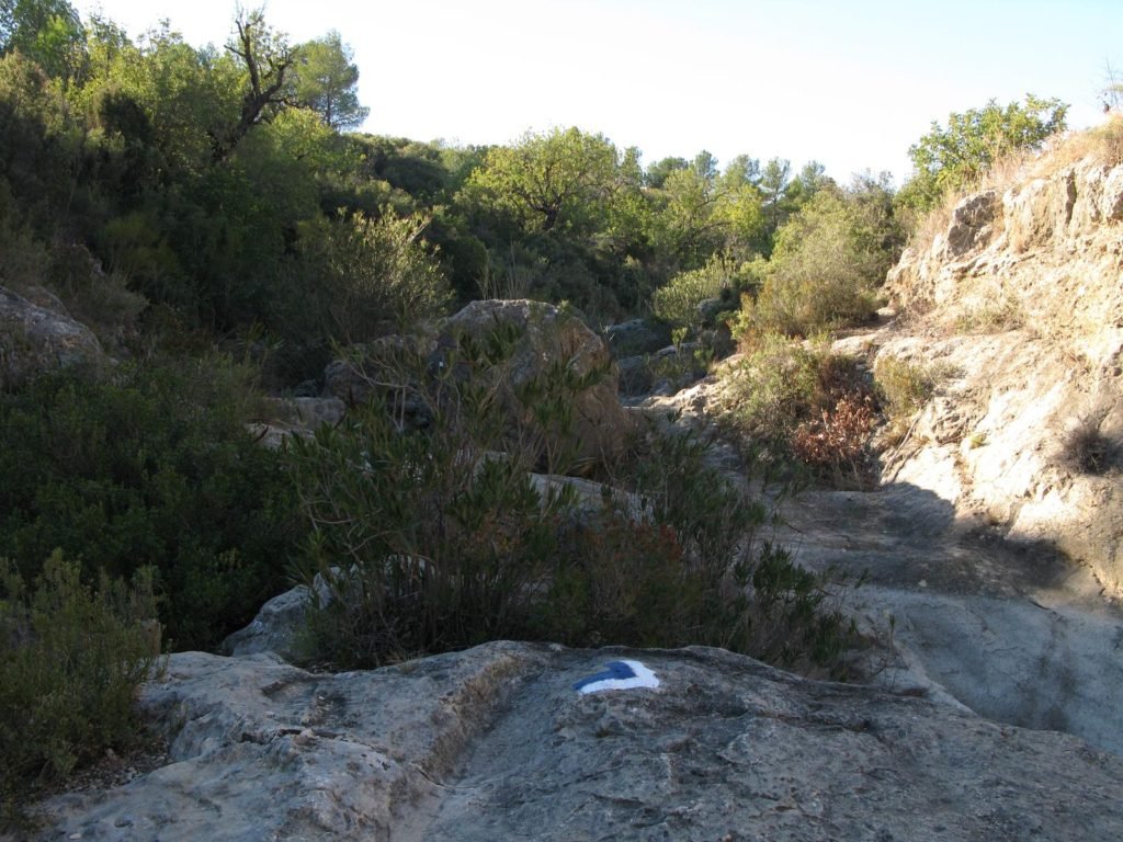
The Almadenes Canyon is a stunning natural gorge carved by the Segura River, located between Cieza and Calasparra in the Region of Murcia. Characterized by towering limestone cliffs reaching over 100 meters in height, the canyon offers a dramatic landscape ideal for hiking and exploration. The area is rich in biodiversity, serving as a habitat for species such as otters, kingfishers, and Bonelli's eagles. Hikers can enjoy scenic trails along the riverbanks, visit prehistoric cave paintings in La Serreta and Los Monigotes caves, and experience activities like kayaking and canyoning. The Almadenes Canyon is a protected natural area, ensuring the preservation of its unique geological and ecological features.
Highlights: Impressive cliffs, the Serreta Cave with Palaeolithic cave paintings, and the Mulata footbridge.
Difficulty: Moderate.
Details: This 8 km circular route follows the GR-127 trail along the Segura River, offering stunning canyon views.


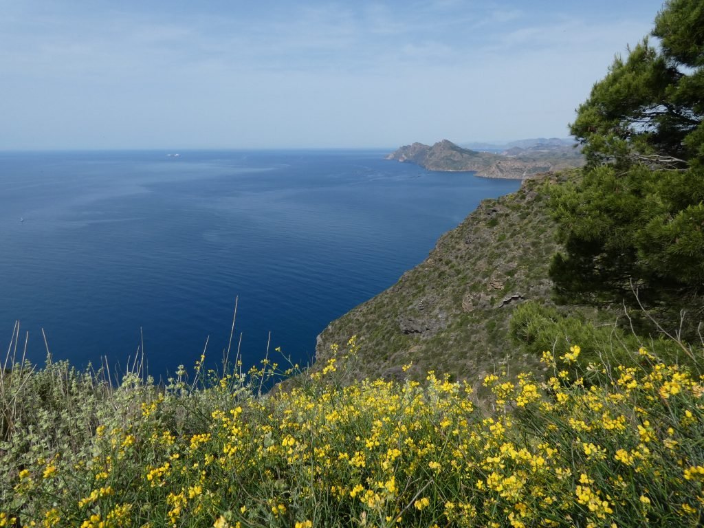
Monte de las Cenizas (Calblanque Regional Park)
Monte de las Cenizas, located within Calblanque Regional Park near Cartagena, offers hikers a captivating blend of coastal beauty and historical intrigue. This 6.05-mile loop trail, rated as moderate, takes approximately 2 hours and 54 minutes to complete. The path meanders through dense pine forests, providing shade and a serene atmosphere. As you ascend, the trail rewards you with panoramic views of the Bay of Portmán and the Mar Menor. At the summit, you'll encounter the Monte de las Cenizas military battery, a historical structure dating back to 1931, offering a glimpse into the area's past. The route also passes through areas of Mediterranean scrubland, showcasing the region's diverse flora and fauna. Whether you're a history enthusiast or a nature lover, this trail provides a memorable hiking experience.
Highlights: Coastal cliffs, secluded beaches, and diverse ecosystems.
Difficulty: Easy to moderate.
Details: A 9 km route that combines coastal and mountain landscapes, ideal for a half-day hike.


Sierra del Puerto
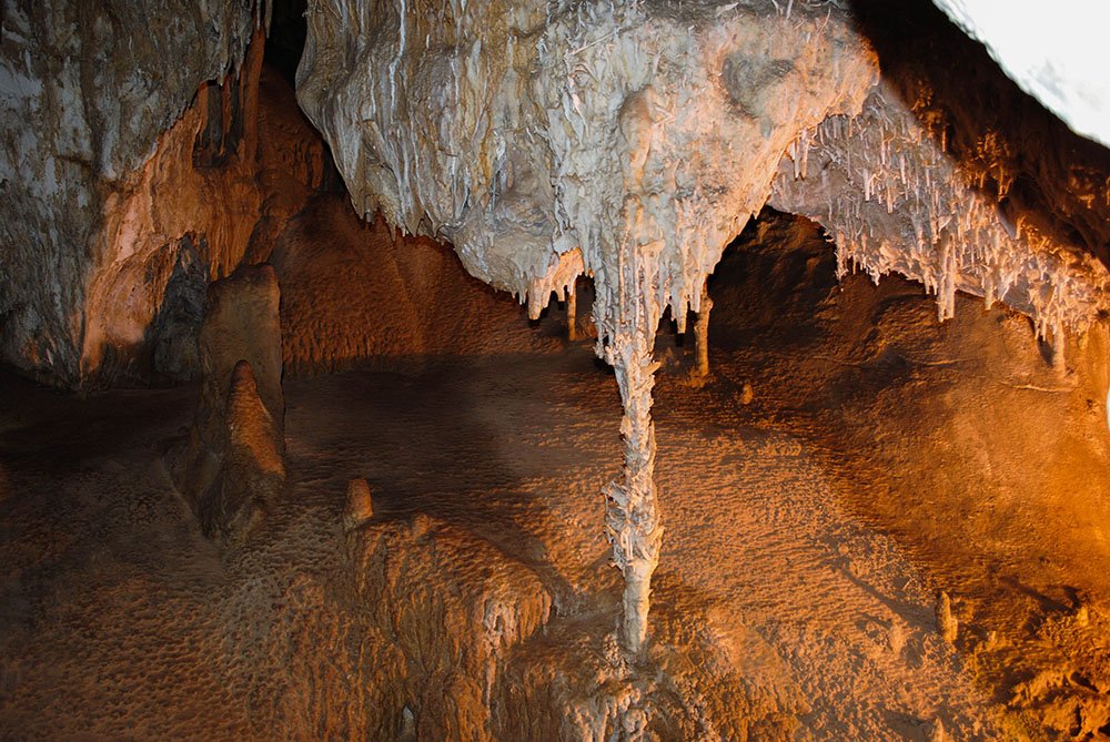
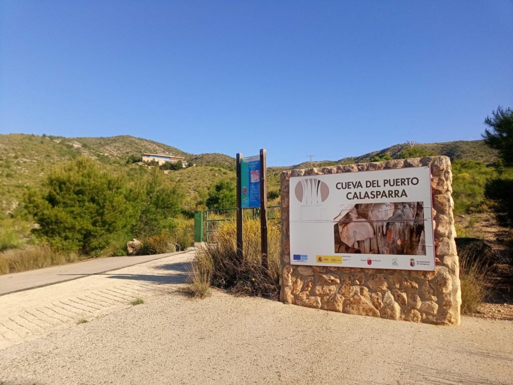
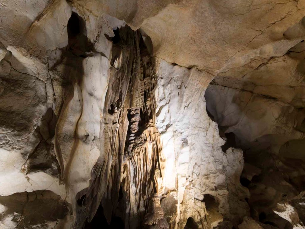
Located in the northwest of the Region of Murcia, Sierra del Puerto is a mountain range that forms part of the Prebético Externo unit of the Betic Cordillera. It is characterized by its calcareous geology, with materials dating back to the Upper Cretaceous period. The range features rugged terrains and is home to various species of flora and fauna. Notable attractions in the area include the Cueva del Puerto, a natural cave system known for its impressive speleothems, and the Cabeza del Asno peak, which offers panoramic views of the surrounding landscapes. The region is also rich in cultural heritage, with remnants of historical settlements and structures scattered throughout the area.
Highlights: Panoramic views of the Mediterranean coast and surrounding mountains.
Difficulty: Moderate.
Details: Located in northern Murcia, this range offers well-marked trails through pine forests and rocky terrain.
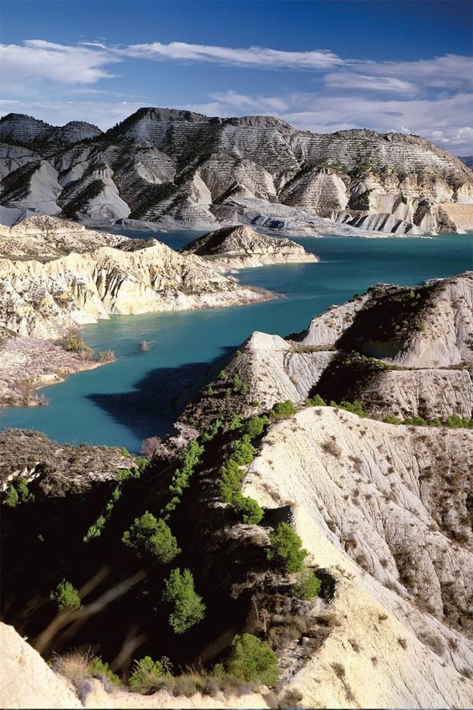
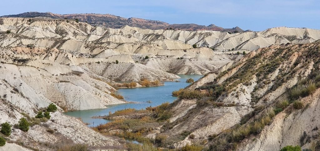
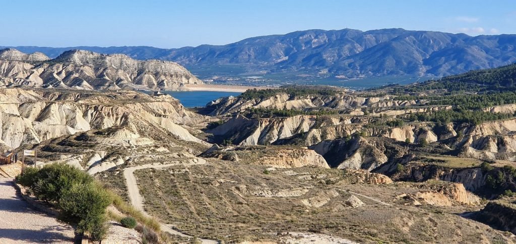
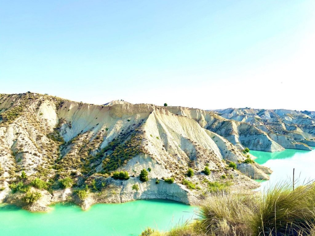
Gebas Desert (Barranco de Gebas)
Barranco de Gebas, located in the Region of Murcia, Spain, is a unique and protected natural landscape renowned for its striking "badlands" terrain. This area, covering approximately 2,000 hectares between the municipalities of Alhama de Murcia and Librilla, features a dramatic topography shaped by centuries of erosion. The landscape is characterized by deep gullies, ravines, and canyons, creating a moonscape-like appearance
Highlights: Unique lunar landscape, dramatic ravines, and dry riverbeds.
Difficulty: Challenging; navigation skills recommended.
Details: A surreal, semi-desert area best explored with a guide or GPS due to overlapping trails.

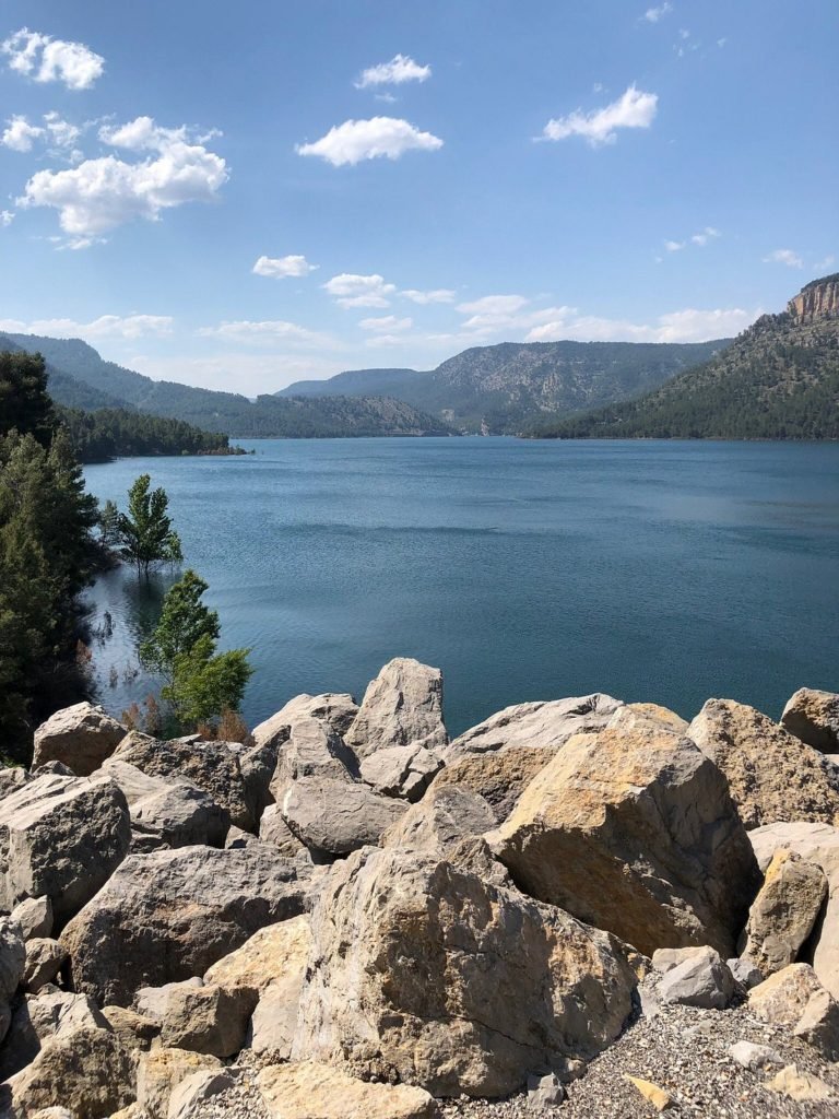
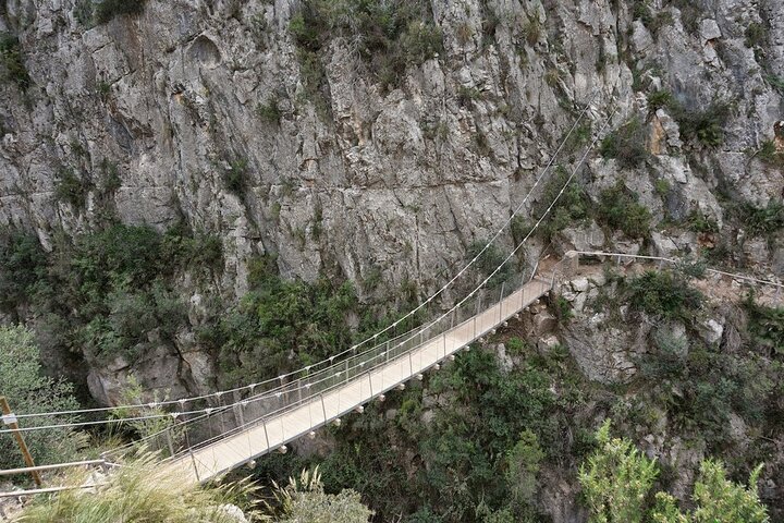
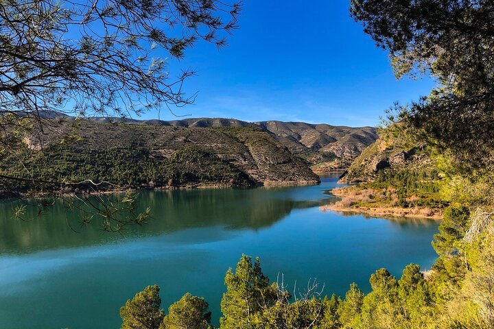
Ruta de los Puentes Colgantes (Chulilla)
The Ruta de los Puentes Colgantes in Chulilla is one of the most spectacular trails in the Valencian Community. This 10 km circular route takes you through the stunning Turia River Canyon, where you’ll cross two historic hanging bridges. The trail offers breathtaking views of the canyon, the turquoise waters of the Loriguilla reservoir, and the surrounding landscape. Along the way, you’ll explore Mediterranean forests, rocky paths, and diverse wildlife. Suitable for all levels, it’s a perfect mix of history, nature, and adventure. Whether you’re a seasoned hiker or a nature enthusiast, this trail promises an unforgettable experience.
Highlights: Suspension bridges, narrow gorges, and turquoise waters.
Difficulty: Moderate.
Details: A popular route featuring multiple hanging bridges over the Turia River, offering breathtaking views.
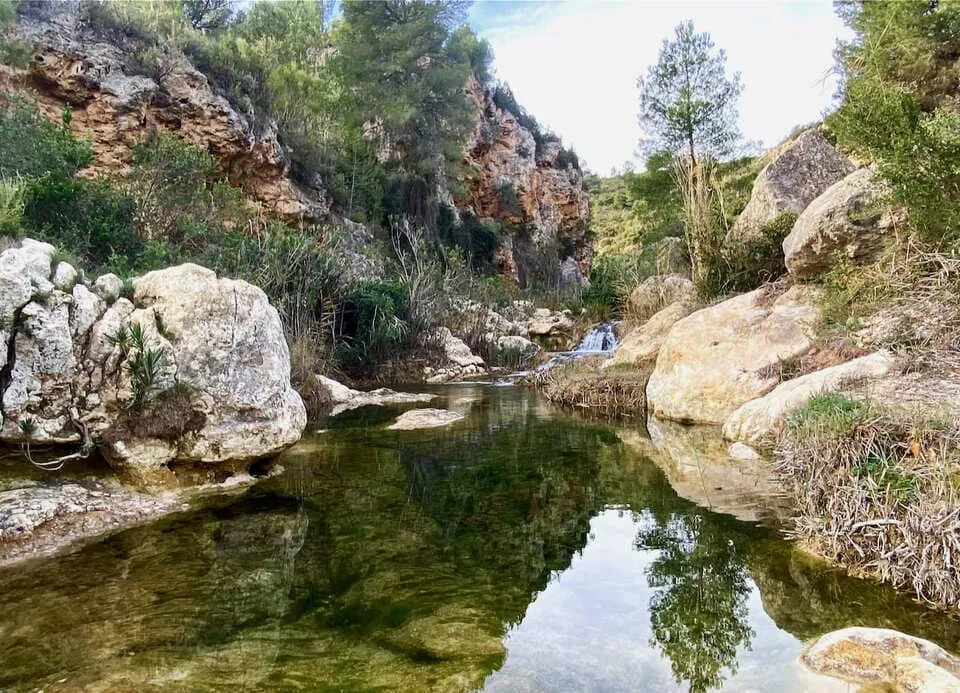
Ruta del Agua (Buñol)
The Ruta del Agua in Buñol is a scenic circular hiking trail approximately 10 km long, suitable for all ages and fitness levels. It begins at Parque San Luis and meanders through the picturesque Hoya de Buñol region, passing through lush Mediterranean forests and offering views of the Buñol River. Highlights include the impressive Cueva del Turche waterfall, the tranquil Charco Mañán pools, and the serene Cueva de las Palomas. The route provides a refreshing escape into nature, ideal for a day trip from Valencia.
Highlights: Cascades, lush vegetation, and historic water channels.
Difficulty: Easy to moderate.
Details: This trail follows ancient irrigation channels, leading to beautiful waterfalls and pools.


Aqueducto de Peña Cortada (Chelva)
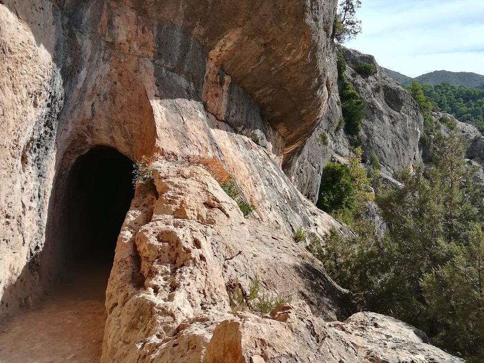
The Peña Cortada Aqueduct is a remarkable Roman engineering feat located in the La Serranía region of Valencia. Built in the 1st century AD, it spans approximately 28.6 kilometers, connecting the river Tuéjar to the plains near Llíria. The aqueduct is renowned for its impressive structures, including the Peña Cortada section—a vertical rock cut nearly 50 meters long and 25 meters high—and the three-arched bridge over the Barranco de la Cueva del Gato. Accessible via a scenic hiking trail from Chelva, the route offers a fascinating journey through tunnels, bridges, and natural landscapes, making it a must-visit for history enthusiasts and nature lovers alike.
Highlights: Roman aqueduct, tunnels, and scenic river views.
Difficulty: Moderate.
Details: A 13.8 km loop trail that combines history and nature, passing through tunnels and alongside the aqueduct.


Forat de Bèrnia (Benissa, Alicante)
Forat de Bèrnia is a remarkable natural tunnel located in the Sierra de Bèrnia mountain range, near Benissa, Alicante. This 15–20 meter long passageway allows hikers to traverse from the northern to the southern side of the mountain. The tunnel offers breathtaking panoramic views of the Mediterranean coastline, including Altea, Benidorm, and the Sierra de Aitana. Accessible via a moderate circular trail (PR-CV 7), the hike also features the 16th-century Fort de Bèrnia and prehistoric cave paintings, making it a must-visit for nature enthusiasts and history buffs alike.
Highlights: Mountain pass, panoramic views, and a unique rock formation.
Difficulty: Moderate to challenging.
Details: A circular route through the Bèrnia mountain range, featuring a tunnel and stunning vistas.


Montanejos Family Route
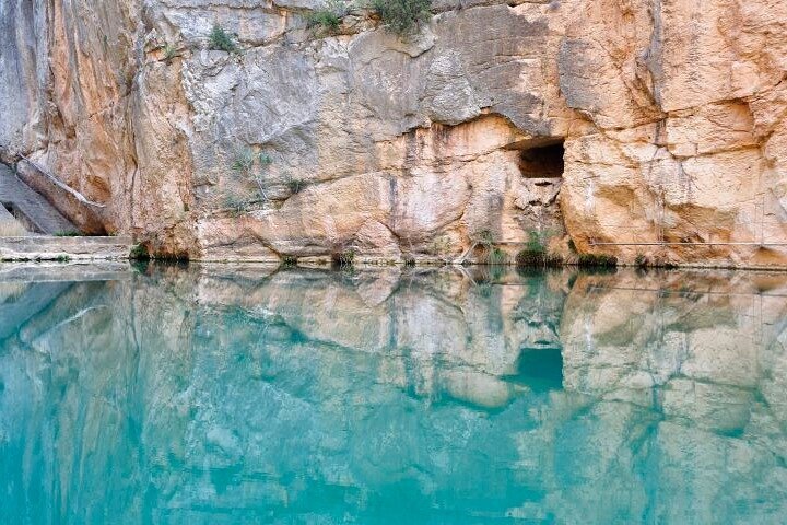
The Sendero Familiar de Montanejos is a scenic circular trail approximately 4.5 km long, ideal for families and hikers of all ages. Starting from the Fuente de los Baños, the route meanders through lush pine forests, offering informative panels about local flora and fauna. Highlights include the impressive Cueva Negra, a natural cave with historical significance, and the tranquil Presa de Cirat reservoir. The trail concludes near the Fuente de los Baños, renowned for its warm thermal waters, providing a perfect spot to relax after the hike.
Highlights: Thermal springs, river pools, and shaded paths.
Difficulty: Easy.
Details: An ideal family-friendly hike that follows the Mijares River, with opportunities for swimming in natural pools.